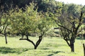
Belvedere path
from the almond tree
Located opposite the Saulières viewpoint on the heights of Faulx, a village of 1,344 inhabitants, this locality is called "Les Tayes," a name derived from its resemblance to an envelope (or a bag), reflecting the shape of the commune's 1,720 hectares. Various tree species make up the numerous woods, but beech trees are the most prevalent in this abundant forest. The beech trees gave their name to the village: Fagorum Vallis de Fagus, meaning "valley of the beeches." From this vantage point, one can distinguish Lower and Upper Faulx and admire the Mauchère Valley, named after the stream that meanders through the village and leaves it with a magnificent waterfall on the western side. A railway line once connected the old tile works at Jeandelaincourt to the factory at Pompey. Today, it has been converted into a greenway, a walking path. Near this viewpoint, in Chavenois, lies the entrance to an 800-meter-long tunnel that connects the Faulx mine to Lay-Saint-Christophe. Hidden on this slope are two springs that supply the village with drinking water: "La Fontaine des Sangliers" and the "Merquenard" spring.